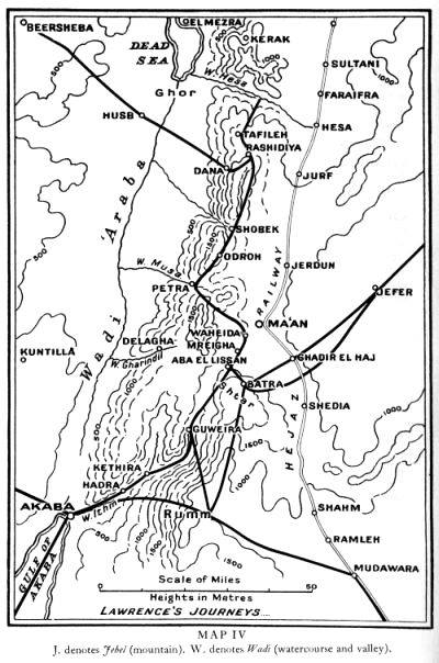
Maps
Hedjaz Railway Map
This map has 3 base map layers:-
- OpenStreetMap.
- OpenTopoMap
The overlying data consists of:-
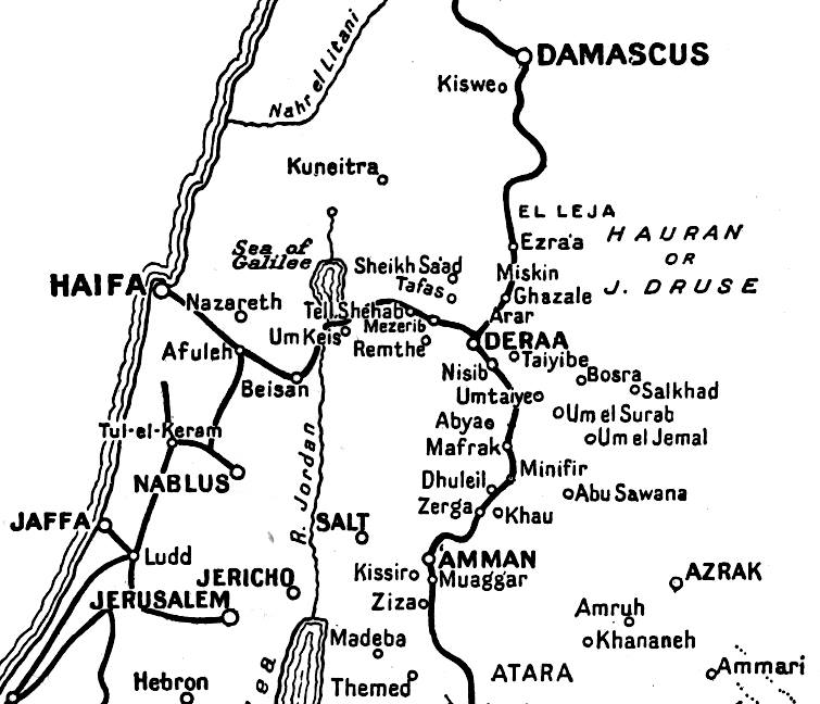
The two Open Street Map layers already show the rail route from Damascus as far as Batu al Ghul (also known as Akaba Junction), it then proceeds to Akaba. This section was built after Lawrence's time to facilitate the export of phosphates from the interior to the coast.
I've continued the route south to Medina where it ends just outside the city. This is because much of the line has been lost to urban development. The stations however are still extant.
I've continued the route south to Medina where it ends just outside the city. This is because much of the line has been lost to urban development. The stations however are still extant.
Apple Map

I've done a web version of Apple Maps. It shows the route and stations only. The default view is a road map but you can change it to show either satellite with or without labels.
The current satellite imagery used by Apple for their Developer Maps is quite good in comparison to other offerings.
The current satellite imagery used by Apple for their Developer Maps is quite good in comparison to other offerings.
Lawrence's Journeys
There will be a series of maps showing the journeys TEL made. The first one will be his journey from El Wejh to Akaba. This journey was the one made famous for several reasons, not least for how it was portrayed in David Lean's film. The thing that interests me is, as stated by Lawrence in the Seven Pillars, the fact that they passed over the extreme western edge of the Nefud, after leaving Bir Fejr and just before El Jaala.
So the map does not become cluttered I have created layers which can be switched on or off as the viewer requires. These are accessible through the lower of the two 'hamburger' menus to be found in the top right of the browser page.
The journey is displayed by the month. The track is displayed by default but can be turned off: and the track data is under your control.
Please note the following:-
In parts I've taken direct lines between points, these are obvious and quite often pass through present day built up areas. This where I've not yet checked the detail or I am unable to find more detail.
Other considerations to the track route include the location of Turkish Outposts in relation to the terrain. The Ottoman army created many outposts, especially those that commanded a great view necessary for defence. The hours that Lawrence spent recording and mapping intelligence data of the Ottoman army back in Cairo would prove very useful for his journeys.
Dates and locations are drawn from diaries, field notes, Arab Bureau reports, letters and the Seven Pillars of Wisdom. More recently work by Ronald Knight and Alison Jolley of the T. E. Lawrence Society.
Finally, and this is a very important point when trying to track TEL's journeys, the Arabian interior mapping information was suspect, Lawrence had proven this; and even more important, camels in such terrain are limited to 3 - 5 mph at best without taking into account the stamina of its rider!
So the map does not become cluttered I have created layers which can be switched on or off as the viewer requires. These are accessible through the lower of the two 'hamburger' menus to be found in the top right of the browser page.
The journey is displayed by the month. The track is displayed by default but can be turned off: and the track data is under your control.
Please note the following:-
- Place names. I have gone to some length to ensure the place names are in the correct geographical position and are those visited by TEL
- The track on the map is not the actual track that TEL undertook. It is my interpretation of a possible route that connects two known positions and general reading of the Arab Bureau Bulletin, using satellite imagery and the beduin tracks that can be seen even today through satellite imagery.
Seven Pillars of Wisdom Map
In my research in to the Seven Pillars of Wisdom map that was included in the subscribers editions, I initially drew a blank. Not until I looked at the 1922 map in greater depth and the names Lawrence gave to places did I get any leads. Finally I found a link to the National Library of Scotland (NLS), where they have the Bartholomew Archive, that once belonged to the great mapping company based in Edinburgh.
There is a link to the NLS map Lawrence approved of on the NLS website, unfortunately the link is not working but to the right is the actual map.
The map or Sketch as it described, shows all Lawrence's journeys but it tell us little else. Most importantly his journey north is omitted. So yes it gives the reader of the SPW a reference to location but that is all.
You can read NLS's Bartholomew Archive by clicking the orange i at the top right of the map.
For anyone wanting to know all about Bartholomew Maps and how cartographers of the past worked, then an online visit to the home of Bartholomew Maps in Duncan Street, Edinburgh is worth a visit.
There is a link to the NLS map Lawrence approved of on the NLS website, unfortunately the link is not working but to the right is the actual map.
The map or Sketch as it described, shows all Lawrence's journeys but it tell us little else. Most importantly his journey north is omitted. So yes it gives the reader of the SPW a reference to location but that is all.
You can read NLS's Bartholomew Archive by clicking the orange i at the top right of the map.
For anyone wanting to know all about Bartholomew Maps and how cartographers of the past worked, then an online visit to the home of Bartholomew Maps in Duncan Street, Edinburgh is worth a visit.
The 1922 Map
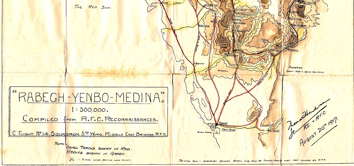
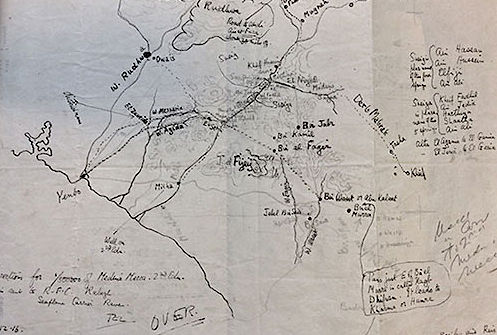
Researching maps of the time, Lawrence's own sketches and those produced just after the war, has been fascinating. The primary reason for the need of accurate maps at the end of the war, was I suspect, to secure the future of oil and the location of oilfields in the region. Not only that there were also the various treaties and agreements made at the Paris Peace Conference 1919-20.
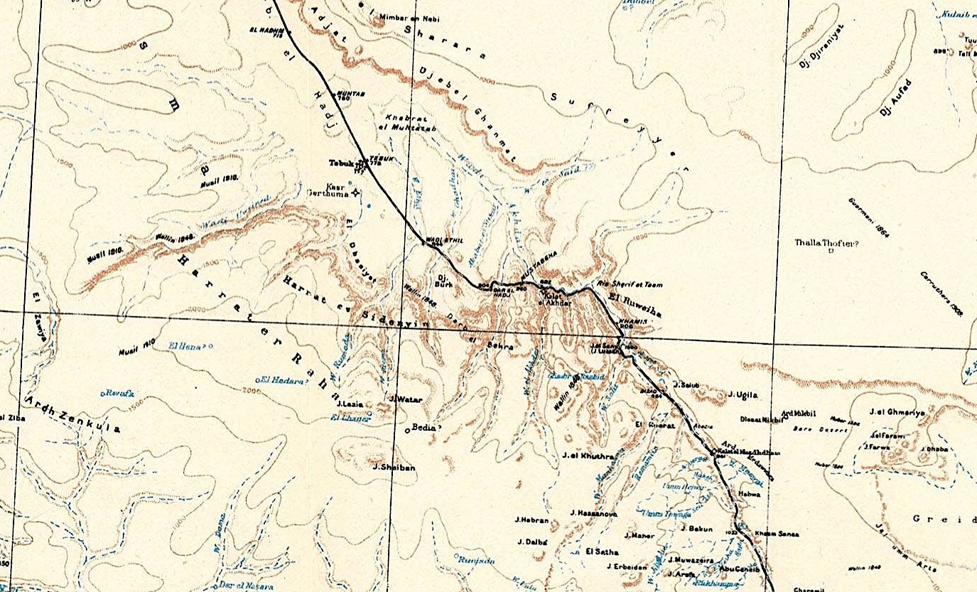
Up until the war, the mapping data was gathered by various explorers and adventurers to the region, many of course were military. As far as Britain was concerned much of this data ended up with either the Foreign Office or more likely with the War Office, whose cartographers did a pretty good job in producing reasonably accurate mapping. Of course other countries also had maps, most notably France and Germany, which were also used by the British.
In order to be able to map Lawrence's journeys accurately on modern day mapping I had one big problem, the interpretation of place names. Lawrence himself debunked the system of translating the Arabic place names. In the Preface to the 1935 edition of the Seven Pillars of Wisdom he remarks, ' There are some "scientific systems" of transliteration, helpful to people who know enough Arabic not to need helping, but a washout for the world. I spell my names anyhow, to show what rot the systems are.'
I now find out that the original mapping done by Bartholomew was out by 30 miles or more. This explains why I have had difficulties in geo-referencing the 1922 map.
The origins of this map are as complex as they could be. Through out the war the cartographers would be no doubt updating the mapping as and when they had new data. Accurate mapping is essential to military planning. I have just recently seen evidence of this and reference made to all the pre war adventurers and explorers who mapped parts of Arabia in their own fashion.
Lurking in the depths of the additional notes in the Arab Bureau Bulletin No 52. The last page reads:
Up until the war, the mapping data was gathered by various explorers and adventurers to the region, many of course were military. As far as Britain was concerned much of this data ended up with either the Foreign Office or more likely with the War Office, whose cartographers did a pretty good job in producing reasonably accurate mapping. Of course other countries also had maps, most notably France and Germany, which were also used by the British.
In order to be able to map Lawrence's journeys accurately on modern day mapping I had one big problem, the interpretation of place names. Lawrence himself debunked the system of translating the Arabic place names. In the Preface to the 1935 edition of the Seven Pillars of Wisdom he remarks, ' There are some "scientific systems" of transliteration, helpful to people who know enough Arabic not to need helping, but a washout for the world. I spell my names anyhow, to show what rot the systems are.'
I now find out that the original mapping done by Bartholomew was out by 30 miles or more. This explains why I have had difficulties in geo-referencing the 1922 map.
The origins of this map are as complex as they could be. Through out the war the cartographers would be no doubt updating the mapping as and when they had new data. Accurate mapping is essential to military planning. I have just recently seen evidence of this and reference made to all the pre war adventurers and explorers who mapped parts of Arabia in their own fashion.
Lurking in the depths of the additional notes in the Arab Bureau Bulletin No 52. The last page reads:
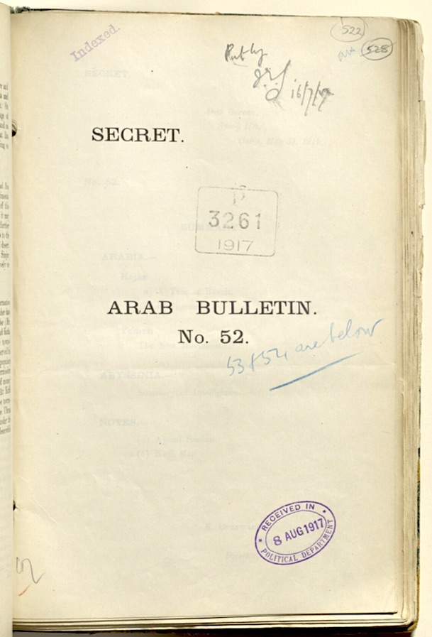
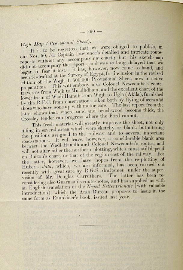
If you care to look closely at the map and fade the 1922 map so that you can see the town of Tayma on the satellite map. Then zoom in slightly keeping the satellite town of Tayma to the left of the map box, but so you can still see it along with the silvery sand to the right. Then gradually reveal the 1922 map until you see the town of Teima just in from the silvery sand. The distance between these two points is approximately 23 miles. This can be repeated throughout the map the greatest discrepancy being to the centre of the map as this is the most remote and least mapped.
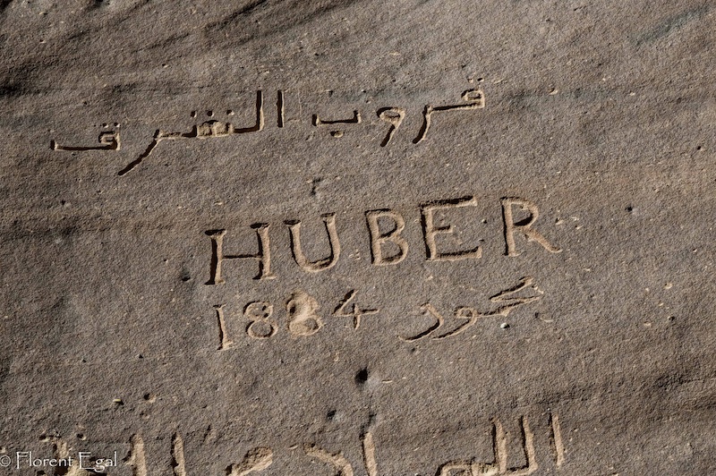
Charles Huber left his mark on more than one occasion!
© Florent Egal.
Notes about the mapping
All the mapping co-ordinates have been inputted by myself using a program called GPS & Map Toolbox on an iPad. Then using various javascripts and Leaflet.js the co-ordinates have been added to free to use mapping. I should like to point out that the route taken by the Hedjaz Railway is disappearing fast. In fact in some places I found it very difficult to map the route and there may well be some errors. Having said that I am confident that I am not far off in many cases where I think there may be errors. When analysing aerial data you very soon learn to pick out features common to the route. Railways tend to follow as level a ground as possible, the turns are generally gradual, in this case some still existing telegraph poles follow the line and so it goes on. In particular where my mapping came to an obvious impass by looking ahead and carefully looking at the terrain other features that only man could have put there in the middle of what is desert, it can sometimes indicate the route. For example culverts, bridge spans and cuttings. Over a period of a 100 years nature has taken back some of the route and man has in parts tarmaced parts and built upon others, this is especially true on the approach to Tabuk, Al Ula and Medina. It is amazing to see how winter flooding in the wadis have washed away the railway embankments but in some cases the bridge abutments have survived as islands. This is more obvious in the Saudi route.
Common to all the maps in satellite mode is the following observation. All photographs that create what we call a satellite view need to be geo referenced. Simply it means that static, long time features or objects that have known co-ordinates have those co-ordinates transferred to the photo image in specialist software which then sort of stretches the photo image to match accordingly. There are many co-ordinate systems used by map makers and some of those systems do not always easily transfer data between the systems. Also within the same system you will find errors where the mapping tiles (as they are called) meet or join. Where they do join, or suppossed to, you may well see ghosting of the two images especially where there is little in the way of data to be geo-referenced. You will see this all along the Hedjaz Railway Route. Where this occurs I've just taken a median line through.
Common to all the maps in satellite mode is the following observation. All photographs that create what we call a satellite view need to be geo referenced. Simply it means that static, long time features or objects that have known co-ordinates have those co-ordinates transferred to the photo image in specialist software which then sort of stretches the photo image to match accordingly. There are many co-ordinate systems used by map makers and some of those systems do not always easily transfer data between the systems. Also within the same system you will find errors where the mapping tiles (as they are called) meet or join. Where they do join, or suppossed to, you may well see ghosting of the two images especially where there is little in the way of data to be geo-referenced. You will see this all along the Hedjaz Railway Route. Where this occurs I've just taken a median line through.